|
UNC DEPARTMENT OF GEOGRAPHY AND ENVIRONMENT
GIS@UNC
October 2026: a new degree, a career night, and big prizes for GIS Day.
|
Oct 19 Geography Unplugged | Nov 4 Career webinar
Nov 14 GIS Day maps due | Nov 18 GIS Day @ Davis Library | Dec 13 Innovative GIS due
|
 |
Put your data on the map: a new B.S. in Geospatial Data Science
The new B.S. launched this fall for students who like technology, coding, and spatial analytics and want to point them at real problems in sustainability, social justice, and global health. It takes data out of spreadsheets and puts it on the map.
Students track climate change, analyze satellite imagery, map disease outbreaks, and design resilient cities. They get hands-on with Python, R, GIS software, Google Earth Engine, and machine learning, and build interactive maps, dashboards, and spatial models.
|
|
Five pillars, 54 to 57 credits
| 30 credits | GIS Methods
Spatial Data Science, GIS, Cartography and Geovisualization, Remote Sensing, applied GIS. |
| 9 credits | Electives
Ethics of Data Science, Information Visualization, Environmental Applications of Drones, and more. |
| 6 credits | Geographic Foundations
The Blue Planet, Weather and Climate, Geographies of Globalization. |
| 6 credits | Mathematical Foundations
Data Science, Data Models, or Calculus. |
| 3-6 credits | Capstone or Honors Thesis
Capstone Seminar in Geographic Research, or an Honors Thesis on a complex spatial problem. |
Questions about enrolling? Email Program Director Dr. David Parr.
|
|
Meet the faculty
Research and teaching across GIS, remote sensing, spatial epidemiology, and environmental science.
David Parr, Program Director
GIS education, VGI, space-time modeling |
Paul Delamater
Health and medical geography, spatial analysis |
Jun Liang
Programming, cartography, urban modeling |
Javier Arce-Nazario
Landscape history, water, sustainability |
Julia Cardwell
Spatial data science education, transportation, extreme weather |
Michael Emch, Kenan Distinguished Professor
Spatial epidemiology, health and environment |
Aaron Moody
Remote sensing, landscape ecology, conservation |
Conghe Song, Department Chair
Remote sensing, ecological modeling, land-use change |
Paul Taillie
Remote sensing, wildlife conservation, global change |
Amanda DelVecchia, Voit Gilmore Fellow
Freshwater and ecosystem ecology, ArcGIS modeling |
|
|
ALUMNI PANEL | OPEN TO ALL UNC STUDENTS
What does a GIS career look like?
Wednesday, November 4 | 6:00 to 7:00 PM
UNC alumni at different career stages and in public, private, and non-profit work share their paths, job-market advice, and how they use spatial skills. Live Q&A at the end.
|
|
Student research, internships, and course spotlight
|
 |
RESEARCH | Addison Lioy, Geography major, GIS and Public Policy minors (Dec 2027)
How Charlotte community organizations respond to federal immigration enforcement
|
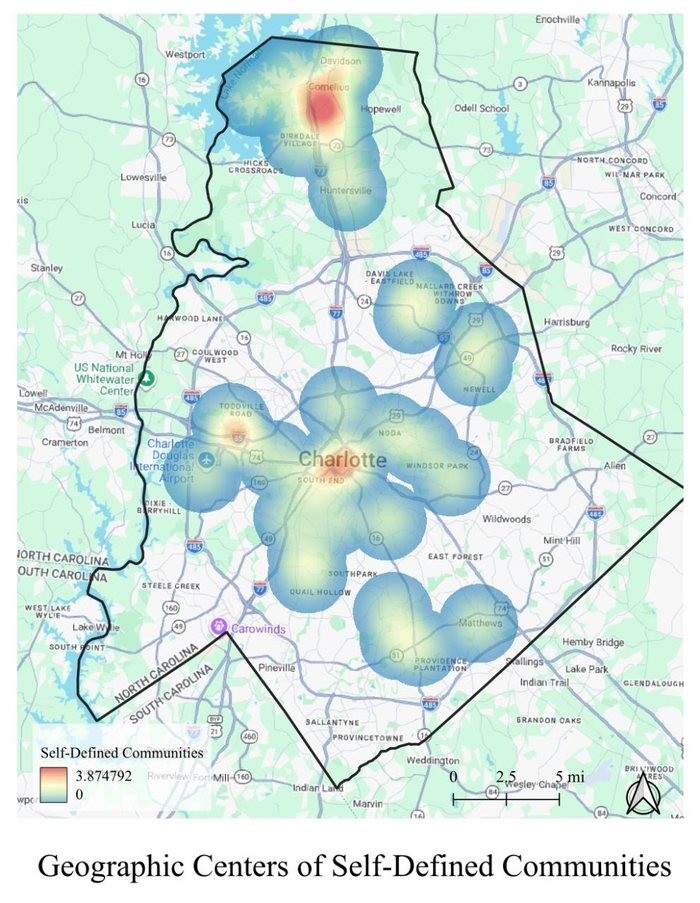
Mentored by Dr. Nina Martin and funded by a Summer Undergraduate Research Fellowship (SURF), Addison did a summer project examining community identity and protest of federal immigration enforcement.
Trying to meet community members, cold emails drew few replies, so she showed up in person at pop-up protests and community meetings and recruited far more participants. Interviewees drew their communities on county maps; she georeferenced them in QGIS, merged the polygons, and tied spatial layers to coded interview themes. Congrats to Addison on her great project!
Geographic Centers of Self-Defined Community, Addison Lioy.
Addison’s advice: talk to someone about a cause you care about. UNC Geography faculty are open and welcoming to excited students.
|
|
|
INTERNSHIP | Charlotte Zimmerman, Geospatial Data Science major (May 2027)
From City of Hickory utilities to the USDA Forest Service
LinkedIn and Handshake went nowhere, so Charlotte went straight to municipal websites. She found an internship with the city of Hickory over the summer. She built a portfolio first by mapping for the non-profit Let Us Lead, which led to work on local city council campaigns.
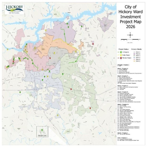
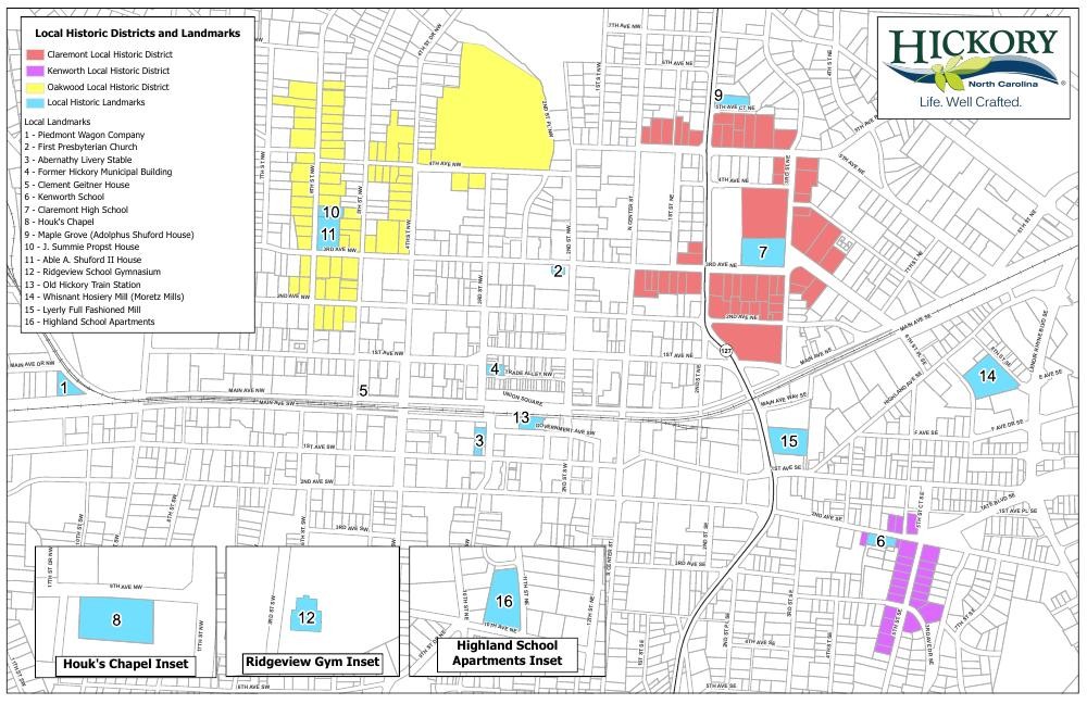
In Hickory she edited attributes in ArcGIS Pro, digitized hundreds of historical paper maps, made ward and trail maps, and spent one day a week at construction sites using ArcGIS Field Maps and ground-penetrating radar to update water and sewer data. Next: digitizing and mapping historic cemeteries in Kentucky for the Forest Service from 1950s USGS topo maps.
MAPS CHARLOTTE MADE FOR THE CITY
Left: City of Hickory Ward Investment Project Map, 2026: 45 projects across six wards, color-coded as in progress, under design, or planned. Right: Hickory’s local historic districts (Claremont, Kenworth, Oakwood) and 16 local landmarks. Maps by Charlotte Zimmerman
Charlotte’s advice: if job boards fail, do GIS projects for people you know, so you have something besides coursework to show.
|
|
 |
COURSE | GEOG 515 Applied Spatial Data Science, with Alex Henson (PhD, year 2)
Forty years of climate trends in one script
|
GEOG 515: Applied Spatial Data Science is taught by Dr. Paul Delamater, and the course showed Alex how R goes beyond point-and-click desktop GIS with open-source, reproducible workflows. Hundreds of gigabytes of data and 40 years of climate trends run from a single automated script. “The beauty of R”, Alex says, “is that you aren’t bound by what tools the software offers but rather have the ability to create any analysis you could imagine.”
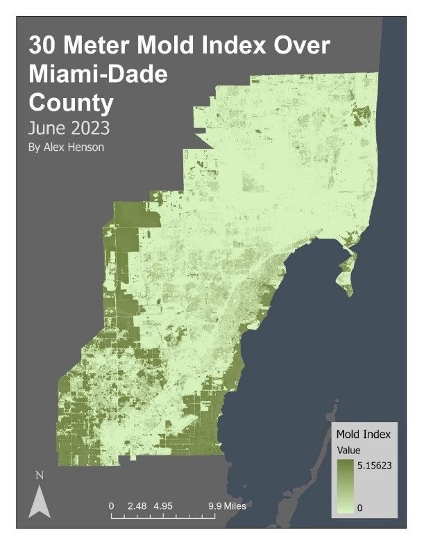
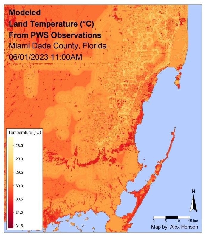
His project combined land cover, tree canopy, impervious surface, and personal weather station data to model 30-meter land temperature and relative humidity for Miami-Dade County. In GEOG 591 with Dr. Amanda DelVecchia, he extended it to mold index estimates by census block group in ArcGIS.
Left: 30 Meter Mold Index Over Miami-Dade County, June 2023. Right: Modeling Land Temperature from PWS Observations. By Alex Henson.
Alex’s advice: If you’re looking for a cool class, talk to your professors. They are just people!
|
|
|
Around the department
|
Geography Unplugged
Monday, Oct. 19 | 3:30 to 5:00 PM | Sitterson Hall SN011
An informal session on major and minor requirements, spring course previews, undergraduate research, and getting on the priority registration list. Free pizza and snacks. Come meet fellow students in Geography and Geospatial Data Science!
|
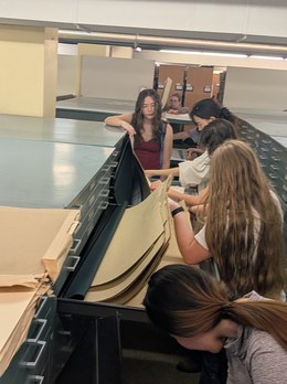 Students excitedly explore the Davis Map Room! |
Interested in a GIS Club?
We have some students interested in forming a GIS club. Possible activities include: community mapathons, industry guest speakers, and field trips to local and regional GIS departments. Interested in helping to form the club? Email Dr. David Parr. |
|
Coffee with the GDS Advisor
Have questions about careers in GIS? What classes to take? How to get internships? What can you do with GIS? On select Fridays, you can get coffee with Dr. Parr. Meet at Carolina 317B and ask your questions!
Friday, October 23 @ 10am
Friday, October 30 @ 10am
Friday, November 6 @ 10am
Friday, November 13 @ 10am
Friday, November 20 @ 10am
|
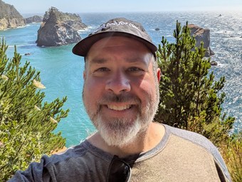 Right: Dr. David Parr, Geospatial Data Science BS advisor (who likes coffee) |
|
|
Map competitions: deadlines approaching
|
Nov 14
UNC GIS Day Map Competition
Open to all students. One map per person, made from the provided datasets.
1st Place: $500; 2nd Place: $300; 3rd Place: $200
Maps will be presented in Davis Library on November 18!
|
|
|
Dec 13
UNC Innovative Use of GIS
First-place undergraduate and graduate winners get the G. Herbert Stout Award ($50 and free registration) and an invitation to present at the NC GIS Conference in Winston-Salem, Feb 3-5, 2027.
|
|
|
|
Career toolkit
The EarthStuff blog by Greg Cocks posts a weekly summary of GIS jobs around the world, including links to job boards and internships. Check out earthstuff.substack.com for the free spatial job roundups on the EarthStuff Substack and LinkedIn newsletter.
|
|
Conferences to know
NC GIS Conference, Feb 3-5, 2027, Winston-Salem
ncgisconference.com |
SEDAAG 2026, Southeastern Division of the AAG: November 22, 2026, Tuscaloosa, AL
sedaag.org/2026-meeting-information |
NACIS Annual Meeting, North American Cartographic Information Society: October 21-24, Milwaukee, WI
nacis.org/annual-meeting/current-meeting |
Esri User Conference, July 12-16, 2027, San Diego, CA
esri.com/uc |
AAG 2027 Annual Meeting, American Association of Geographers: February 8-12, 2027, New York, NY
aag.org/events/aag2027 |
|
|
GIS@UNC
Department of Geography and Environment
University of North Carolina at Chapel Hill
daveparr@unc.edu
|
|